
2014 Photo Gallery
All Photos Copyright © 2014 Henning Umland
These Photos were made during a 5-week trip through Nevada, Arizona, and Utah in April/May 2014.
The RAW image files supplied by the camera (Nikon D300S) were processed with Darktable 1.4.2 and The Gimp 2.8.
Darktable was used to adjust brightness, contrast, saturation, color temperature, and sharpness, and to convert the RAW files to the PNG format.
Afterwards The Gimp was used to do some retouching (dust speckles, vapor trails, wires), correct perspective distortion, and convert the PNG
files to the JPG format.
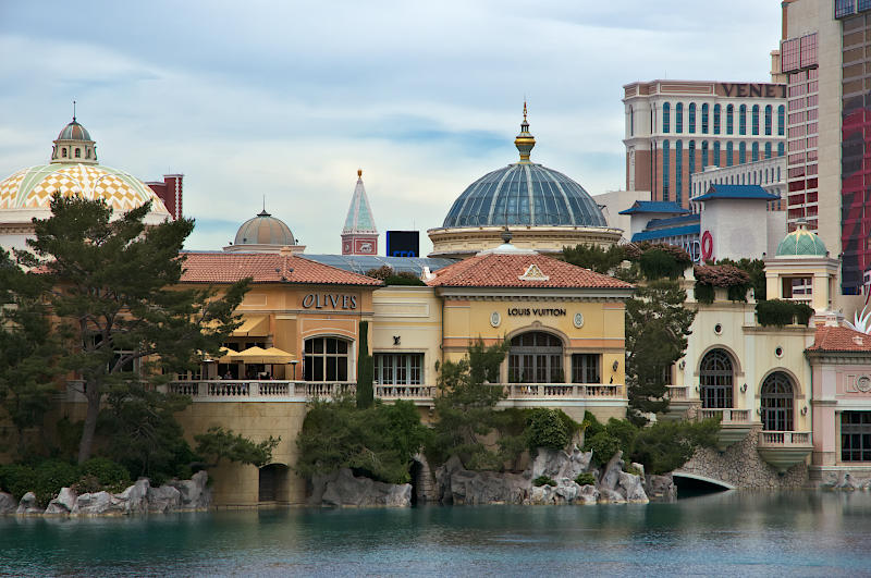 |
Cityscape, Las Vegas, Nevada
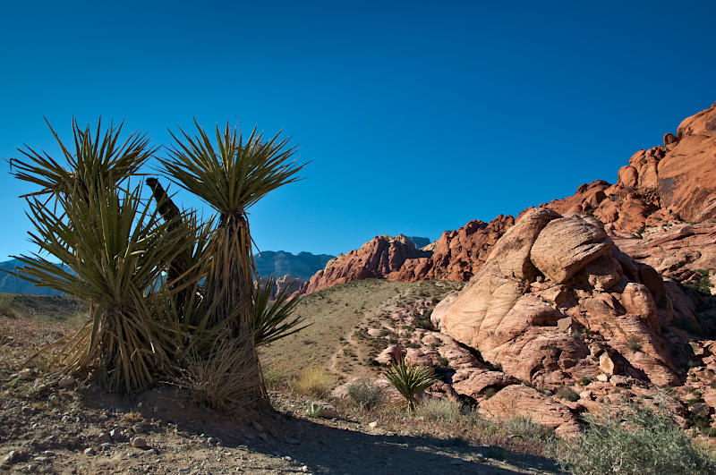 |
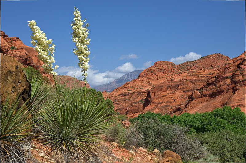
Yucca and Rocks, Redrock Canyon National Conservation Area near Las Vegas, Nevada
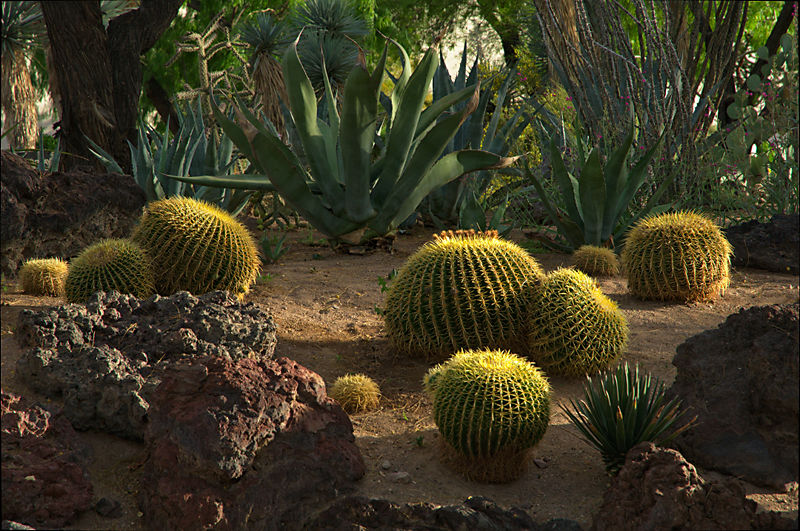 |
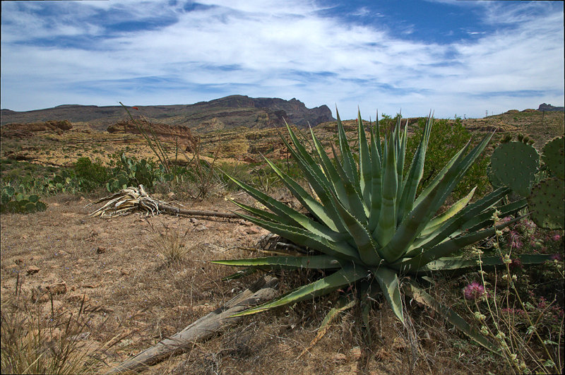
Desert Plants, Private Park, Las Vegas, Nevada
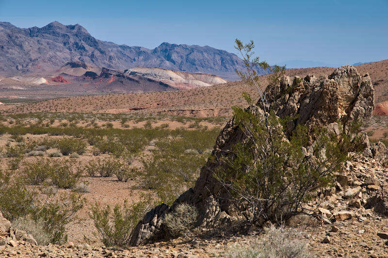 |
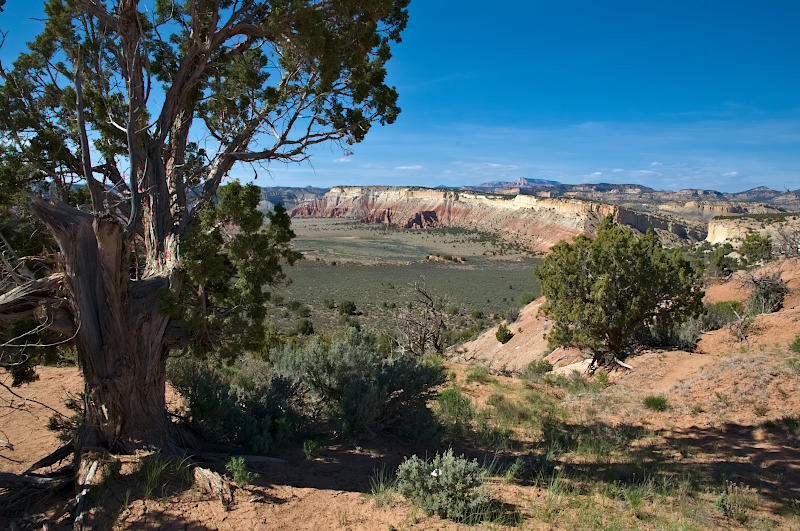
Landscape along Highway 167 east of Las Vegas, Nevada
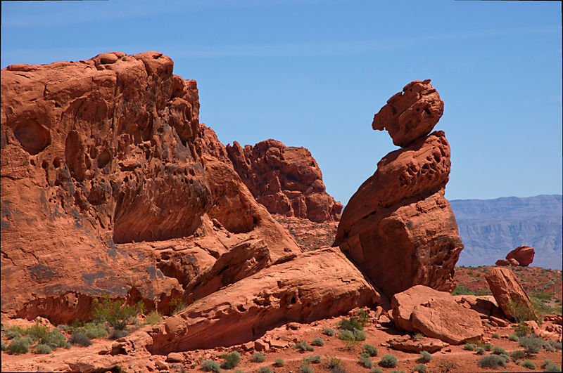 |
Balanced Rock, Valley of Fire SP, Nevada
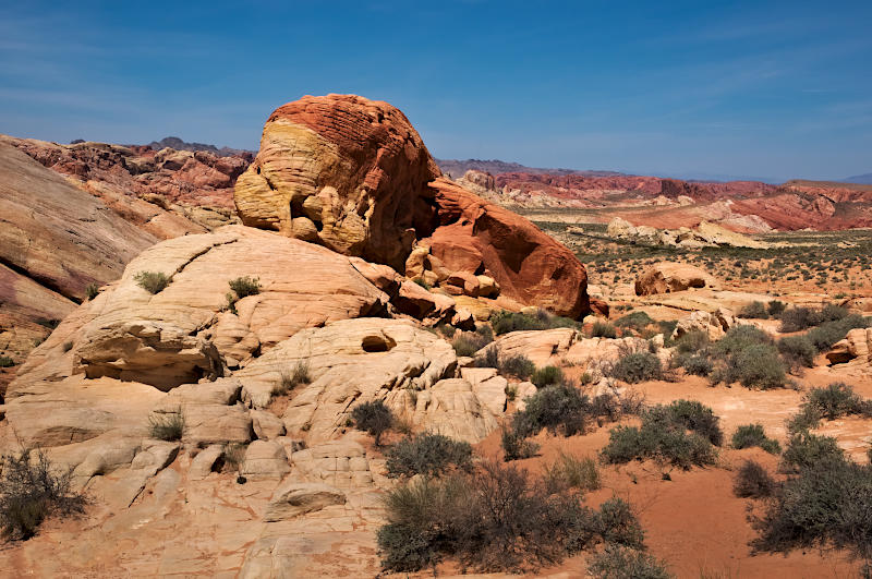 |
Colored Rock, White Domes Area, Valley of Fire SP, Nevada
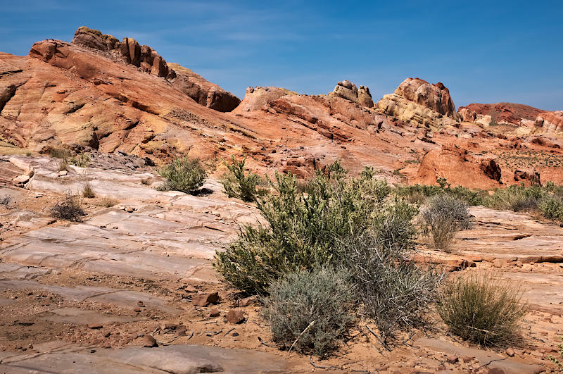 |
Colored Rock, White Domes Area, Valley of Fire SP, Nevada
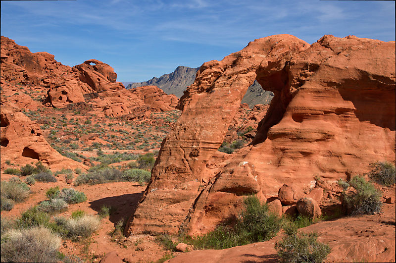 |
Arches near Valley of Fire SP, Nevada
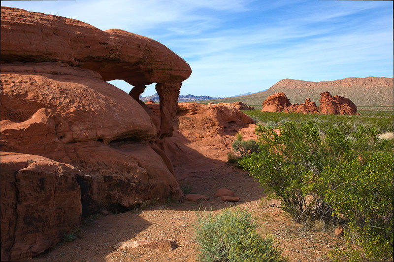 |
Piano Rock, Valley of Fire SP, Nevada
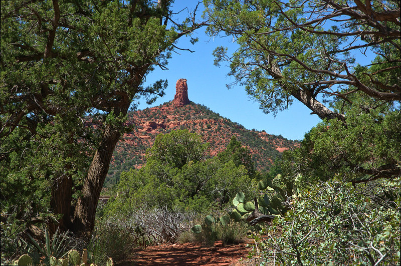 |
Chimney Rock, Sedona, Arizona
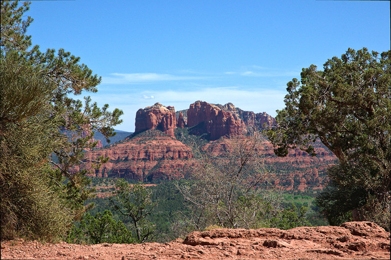 |
Cathedral Rocks, Sedona, Arizona
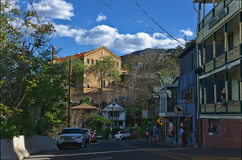 |
Downtown Jerome, Arizona
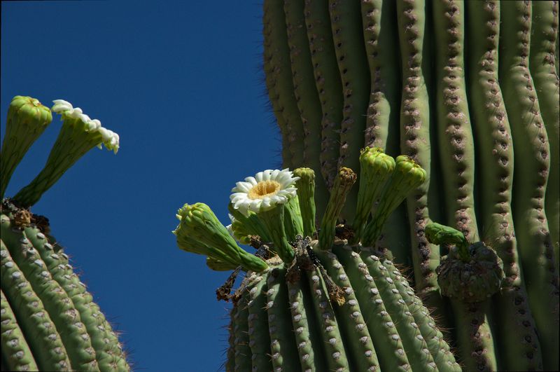 |
Blooming Saguaro, Apache Junction, Arizona
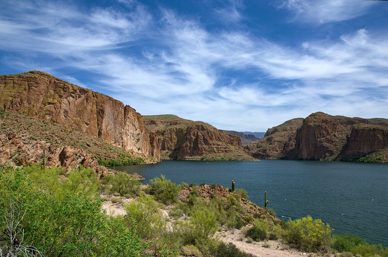 |
Canyon Lake near Apache Trail (Hwy 88), Arizona
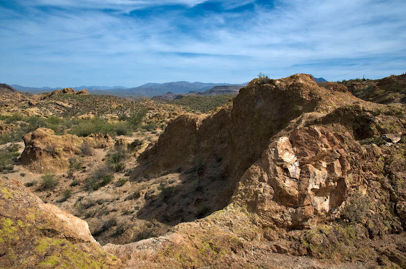 |
Desert Landscape, Apache Trail (Hwy 88), Arizona
 |
Desert Landscape, Apache Trail (Hwy 88), Arizona
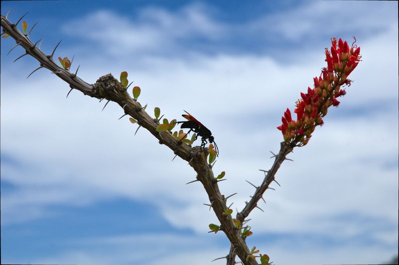 |
Tarantula Hawk on Ocotillo Branch, Apache Trail (Hwy 88), Arizona
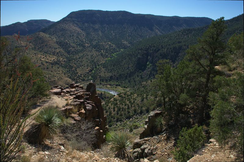 |
Salt River Canyon, Arizona
 |
Painted Desert, Petrified Forest NP, Arizona
 |
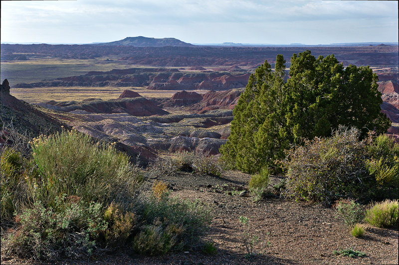
View from Blue Mesa, Petrified Forest NP, Arizona
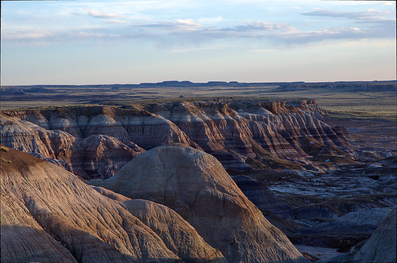 |
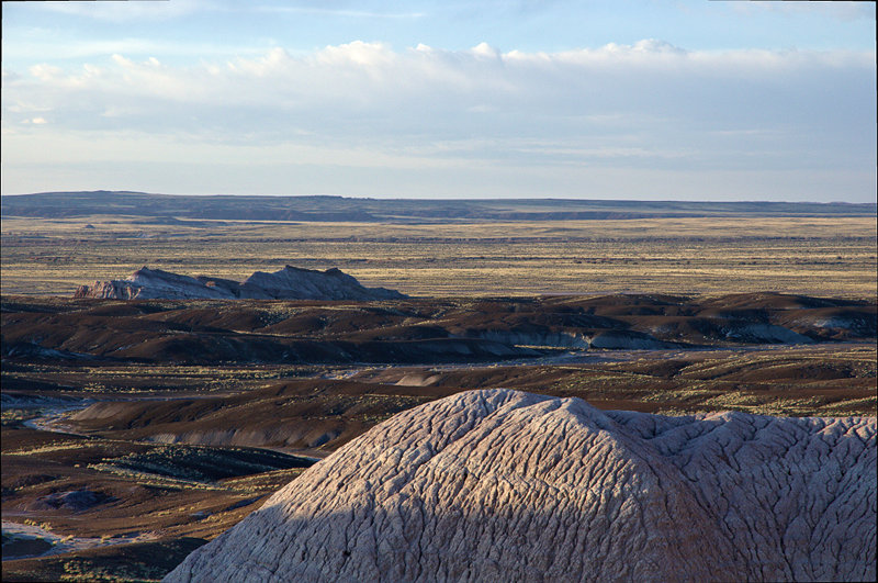
Blue Mesa at Sunset, Petrified Forest NP, Arizona
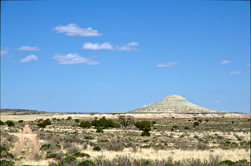 |
White Cone seen from Hwy 77, Navajo Reservation, Arizona
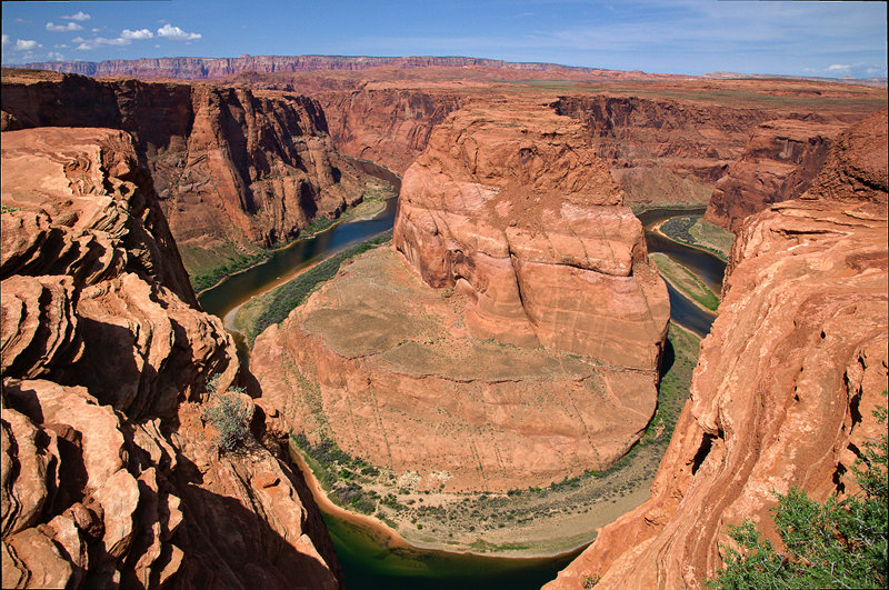 |
Horseshoe Bend, near Page, Arizona
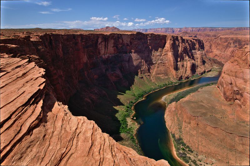 |
Horseshoe Bend, near Page, Arizona
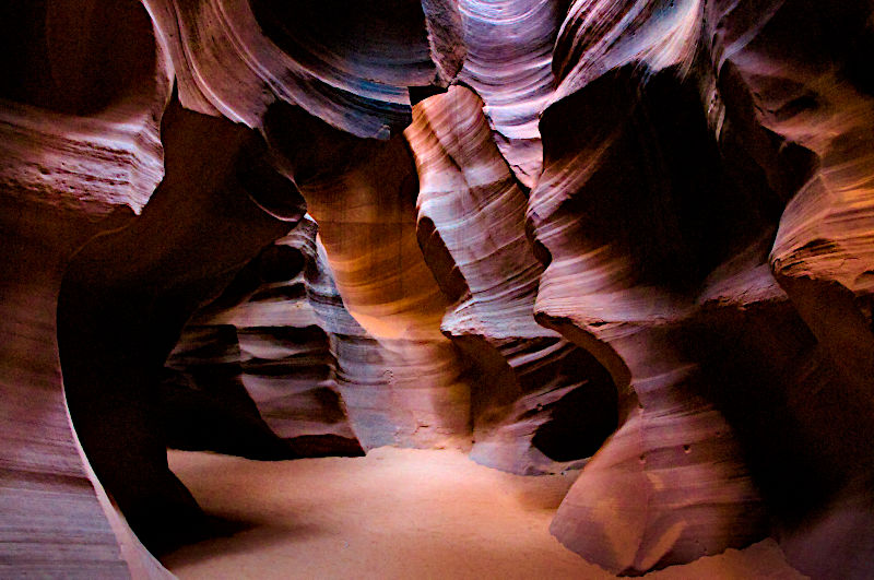 |
Upper Antelope Canyon, near Page, Arizona
Antelope Canyon was a big disappointment to me. This place is extremely crowded with tourists. Hordes of people get channelled through this narrow canyon (both ways at the same time!). In this pushing and shoving, you have to be very patient to get a clear view for a decent photo (if you are at all willing to pay the hefty fees for admittance and camera permit).
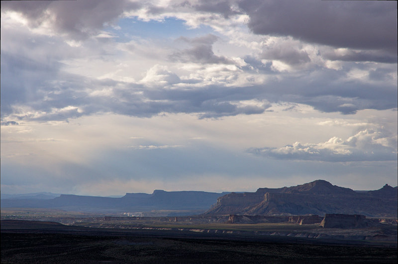 |
Evening Sky with Clouds, near Lake Powell, Page, Arizona
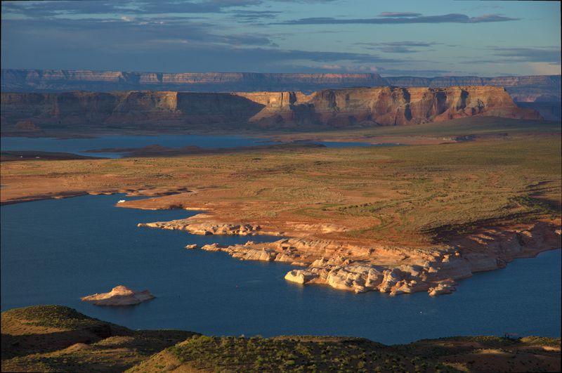 |
Lake Powell seen from Wahweep Overlook, Page, Arizona
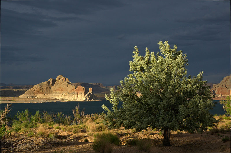 |
Wahweep Bay at Sunset, Lake Powell, Page, Arizona
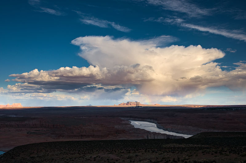 |
Power Plant near Page, Arizona
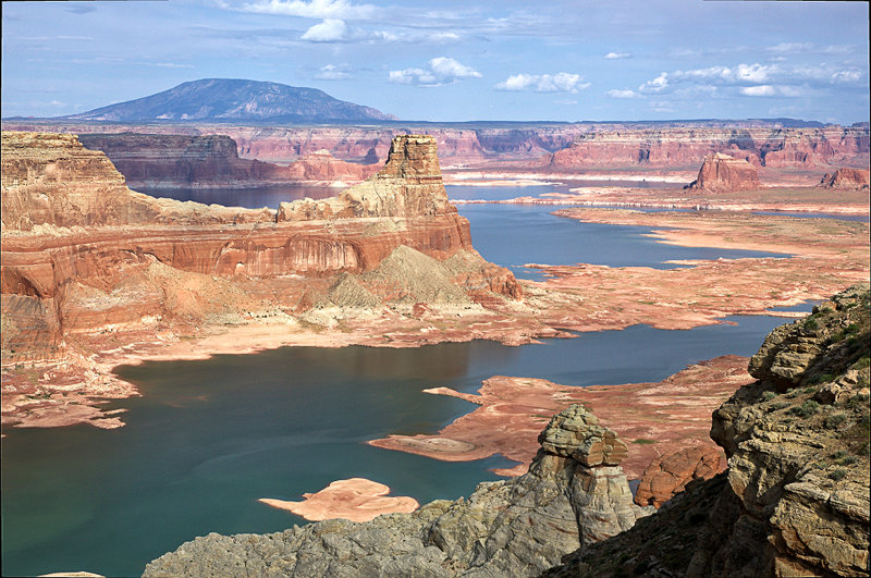 |
Gunsight Bay and Gunsight Butte as seen from Alstrom Point, Glen Canyon NRA, Utah
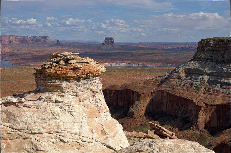 |
Another View from Alstrom Point, Glen Canyon NRA, Utah
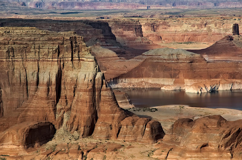 |
Cliffs near Alstrom Point, Glen Canyon NRA, Utah
 |
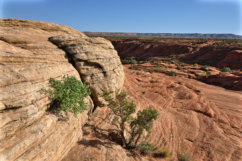
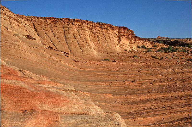
The Rim Rocks, near Hwy 89, Utah
 |
The Rim Rocks, near Hwy 89, Utah
 |
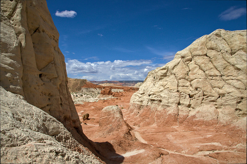
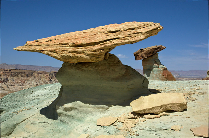
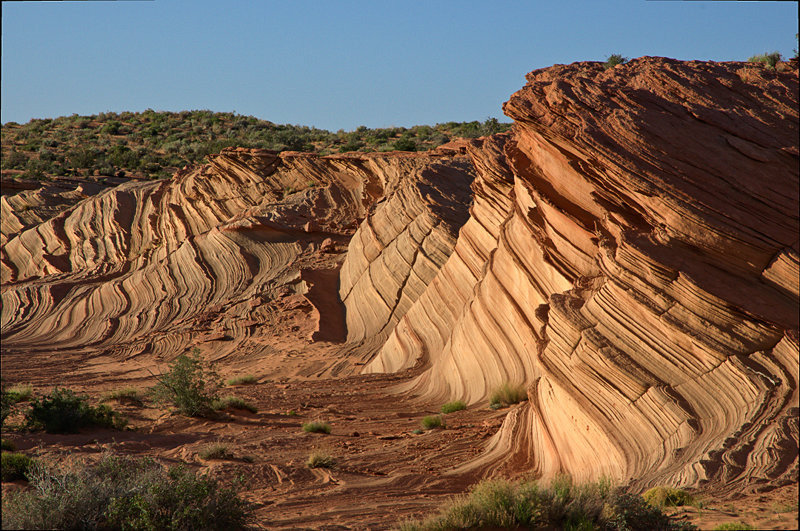
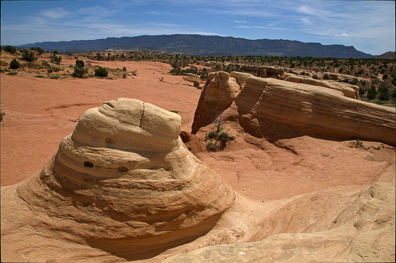
Toadstool Hoodoos, The Rim Rocks, near Hwy 89, Utah
 |
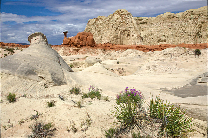
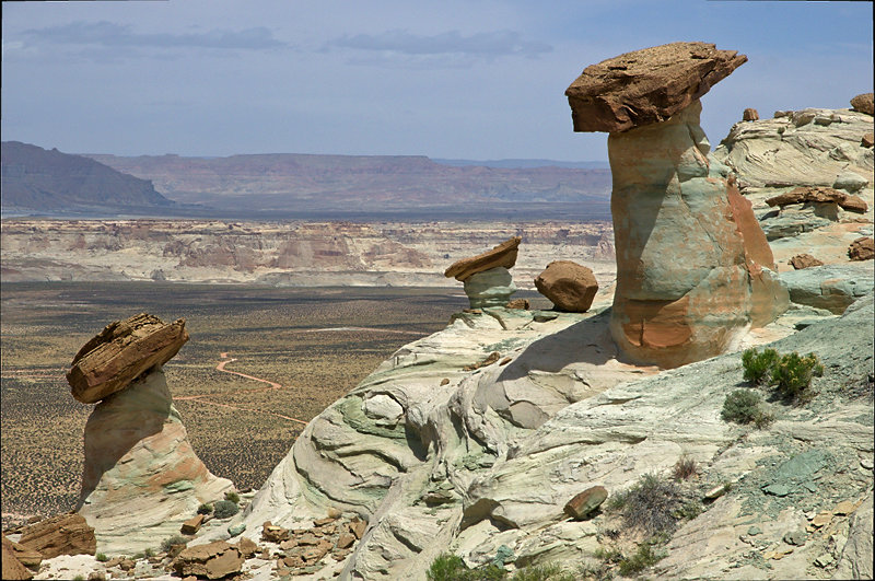
Toadstool Hoodoos, The Rim Rocks, near Hwy 89, Utah
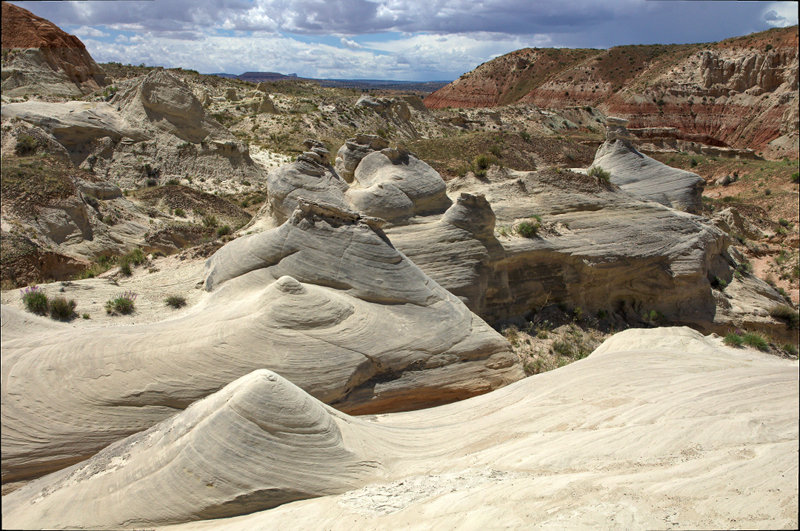 |
Rounded Rocks, The Rim Rocks, near Hwy 89, Utah
 |
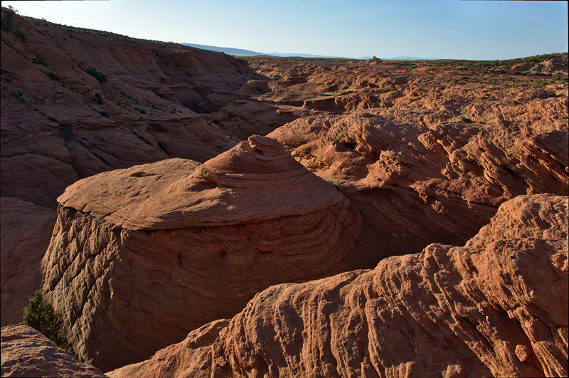
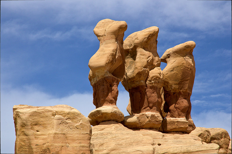
Hoodoos, Studhorse Point, Glen Canyon NRA, Utah/Arizona
 |
Hoodoos, Studhorse Point, Glen Canyon NRA, Utah/Arizona
 |
Waterholes Canyon, near Page, Arizona
 |
Waterholes Canyon, near Page, Arizona
 |
"Great Wall", near Page, Arizona
 |
"Great Wall", near Page, Arizona
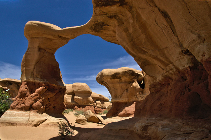 |
Metate Arch, Devil's Garden, Grand Staircase Escalante NM, Utah
 |
Rock Landscape, Devil's Garden, Grand Staircase Escalante NM, Utah
 |
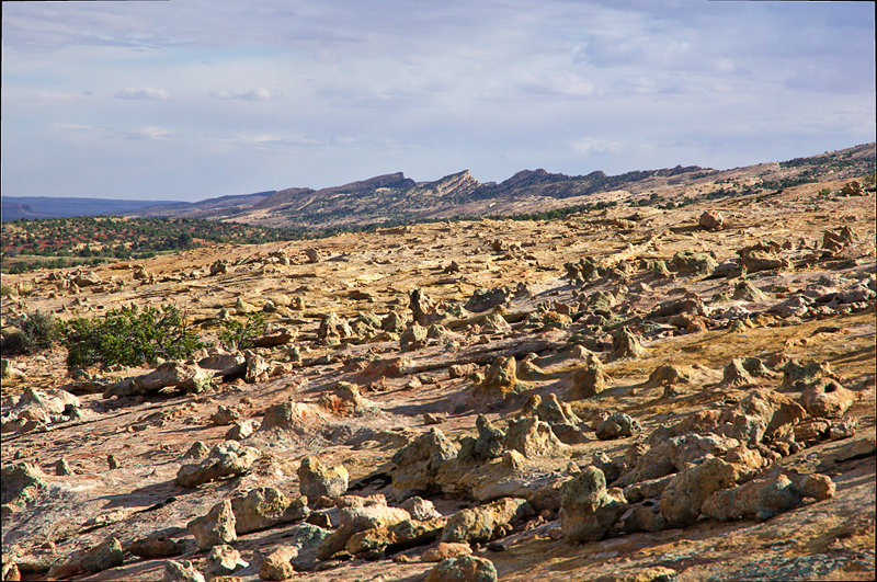
Goblins, Devil's Garden, Grand Staircase Escalante NM, Utah
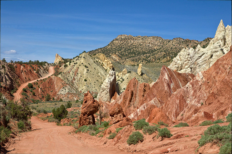 |
Cottonwood Canyon Road, Grand Staircase Escalante NM, Utah
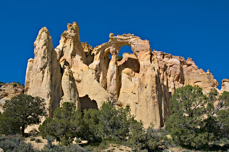 |
Grosvenor Arch, near Cottonwood Canyon Road, Grand Staircase Escalante NM, Utah
 |
Landscape near Cottonwood Canyon Road, Grand Staircase Escalante NM, Utah
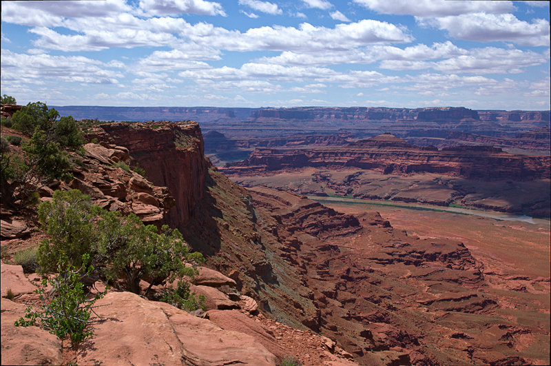 |
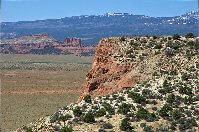
Colorado River seen from Anticline Overlook, Utah
 |
Kane Creek Canyon seen from Anticline Overlook, Utah
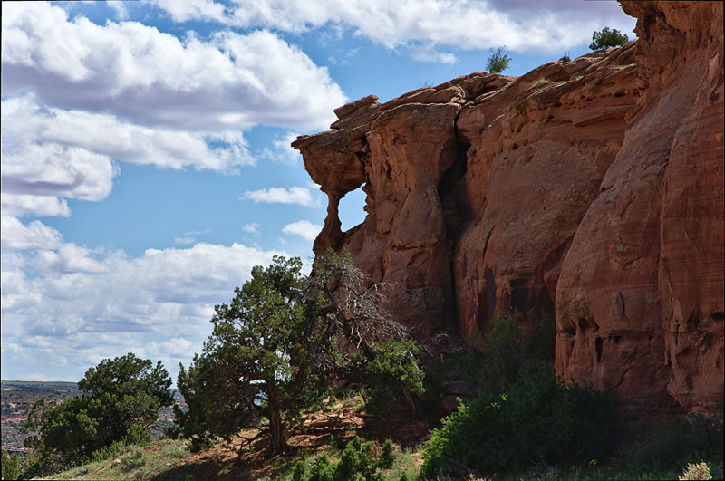 |
The Wine Glass, Anticline Overlook Road, Utah
 |
Long Canyon, near Canyonlands NP, Utah
 |
Rock Landscape, Sandflats Recreation Area, Moab, Utah
 |
Rocks, Sandflats Recreation Area, Moab, Utah
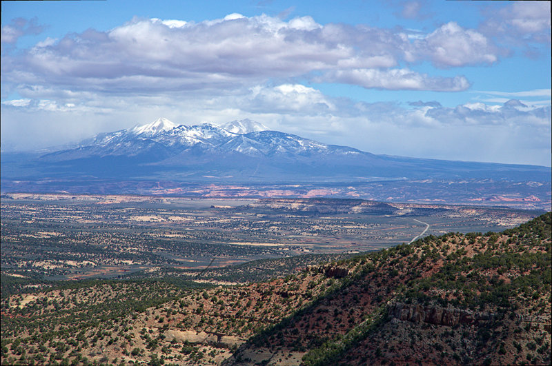 |
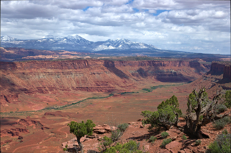
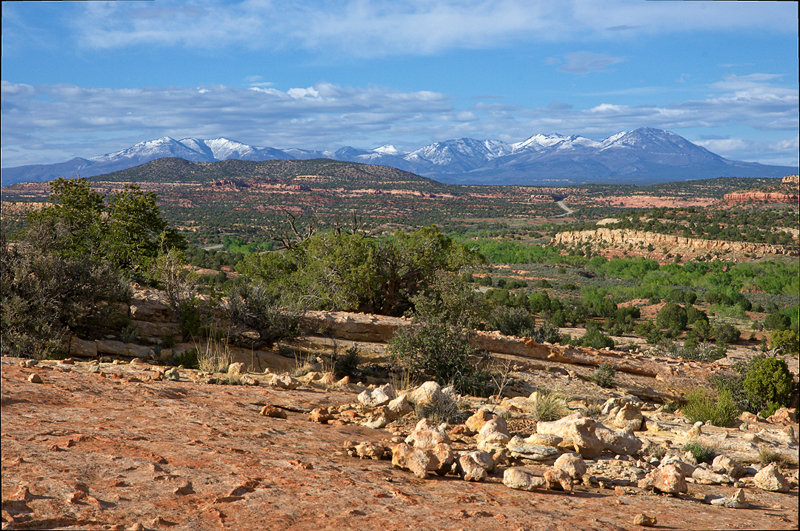
La Sal Mountains seen from Harts Draw Road, Utah
 |
Abajo Mountains seen from Comb Ridge, Utah
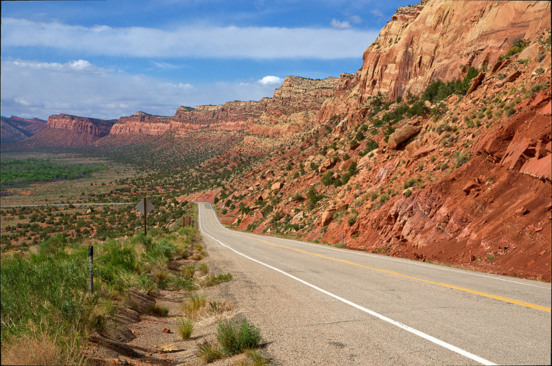 |
Comb Ridge, Hwy 95, Utah
 |
Comb Ridge (Eastern Slope), Utah
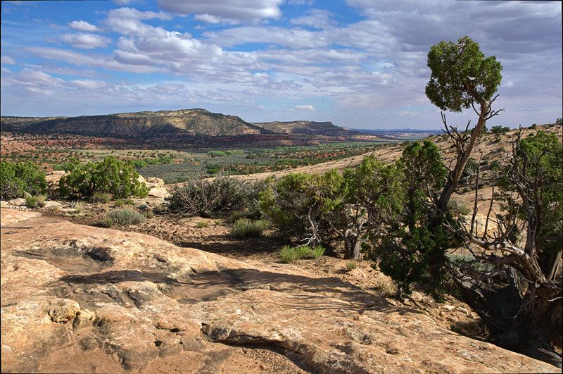 |
View from Comb Ridge, near Hwy 95, Utah
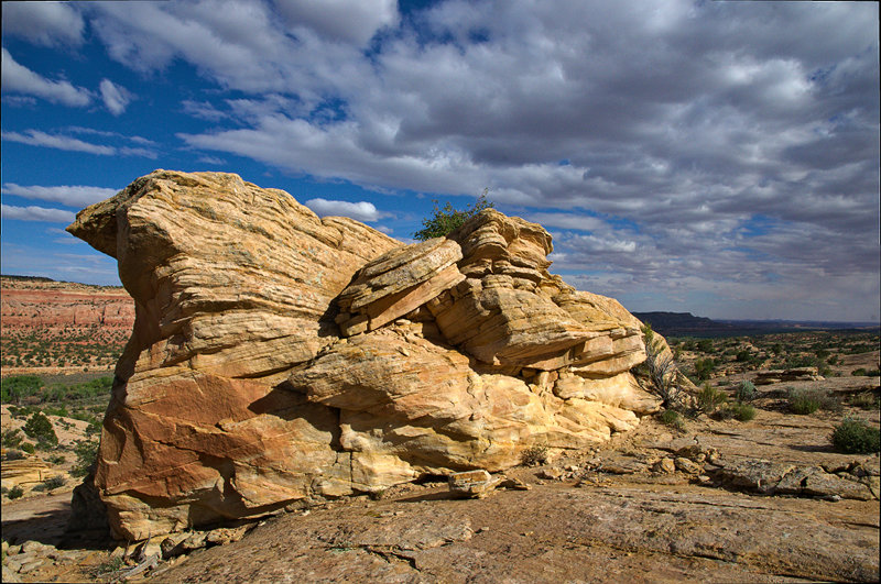 |
Yellow Rock, Comb Ridge, near Hwy 95, Utah
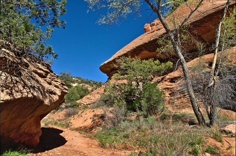 |
Mule Canyon (South Fork), near Hwy 95, Utah
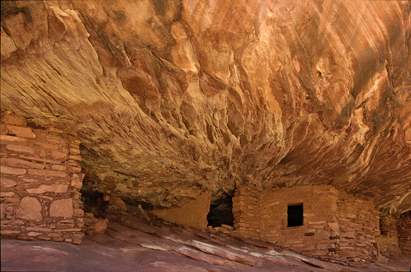 |
House on Fire Ruin, South Fork of Mule Canyon, near Hwy 95, Utah
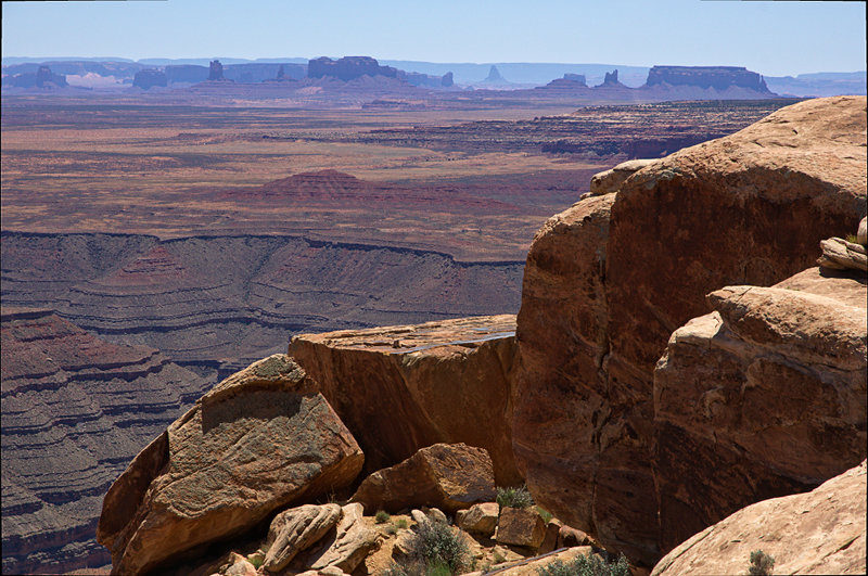 |
Monument Valley seen from Muley Point, Utah
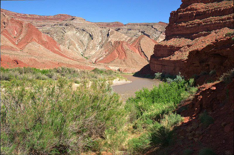 |
San Juan River near Mexican Hat, Utah
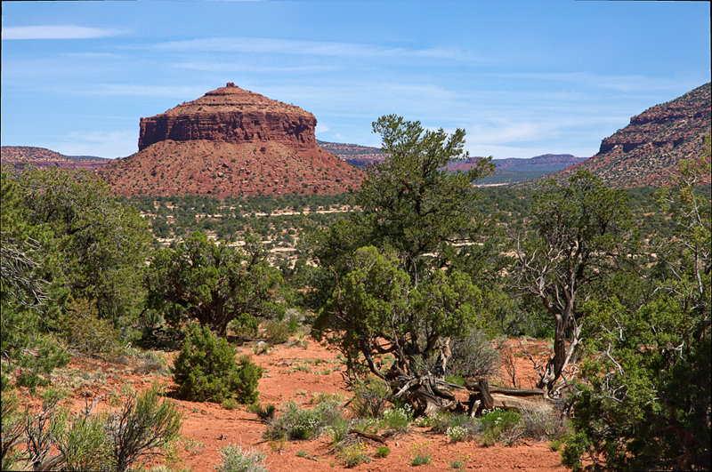 |
Cheesebox Butte seen from Hwy 95, Utah
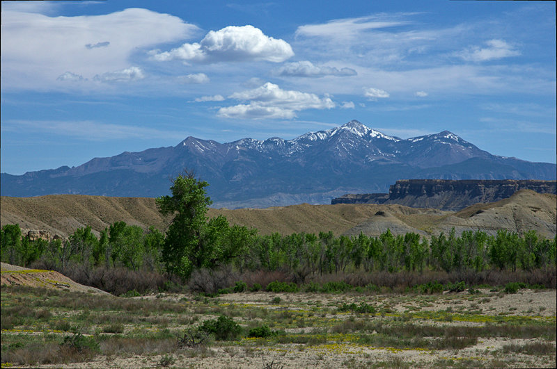 |
Henry Mountains seen from Hwy 24, Utah
 |
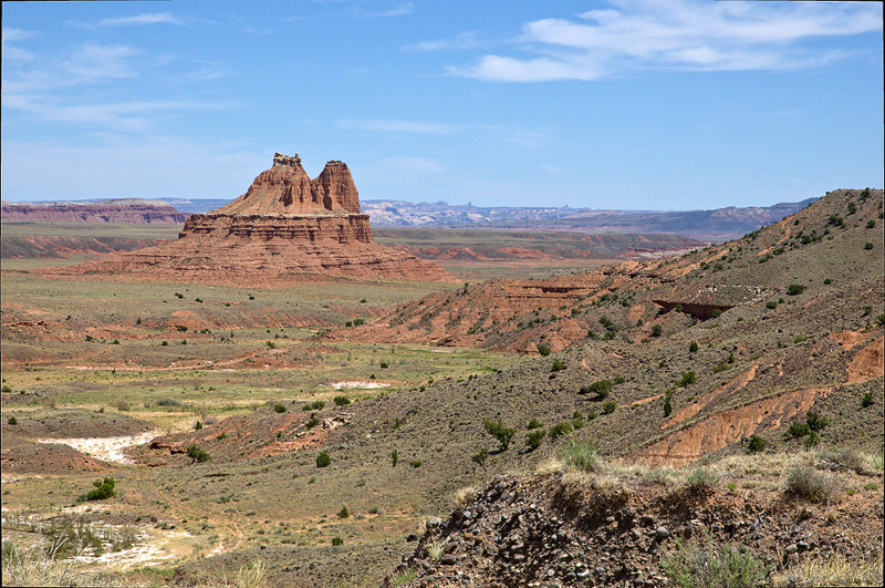
Cathedral Valley seen from Upper Last Chance Road, near Capitol Reef NP, Utah
 |
Solomon's Temple, Cathedral Valley, Capitol Reef NP, Utah
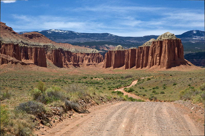 |
Cathedral Valley Road, Capitol Reef NP, Utah
 |
South Desert Overlook, Capitol Reef NP, Utah
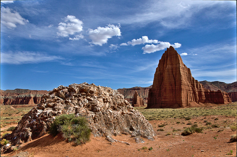 |
Glass Mountain, Temple of the Moon, Temple of the Sun, Capitol Reef NP, Utah
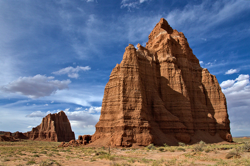 |
Temple of the Sun (Background), Temple of the Moon, Cathedral Valley, Capitol Reef NP, Utah
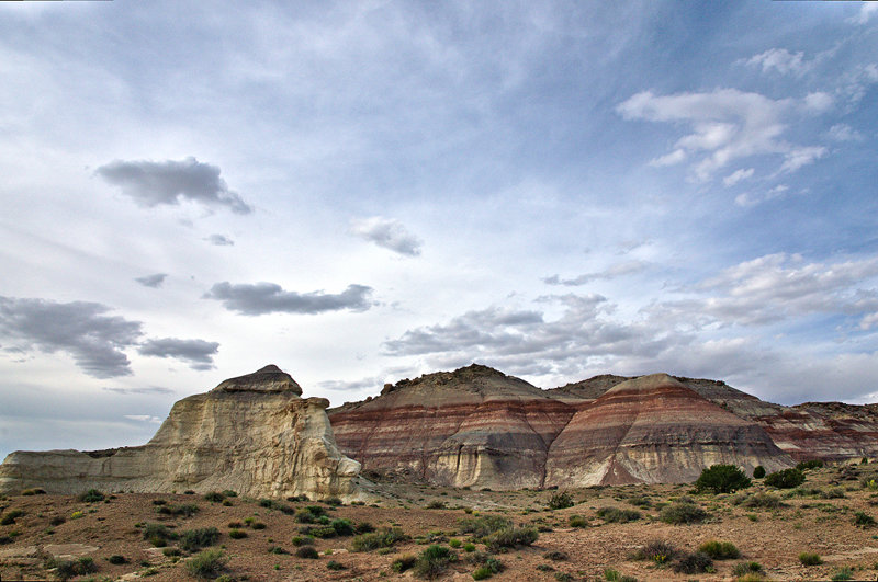 |
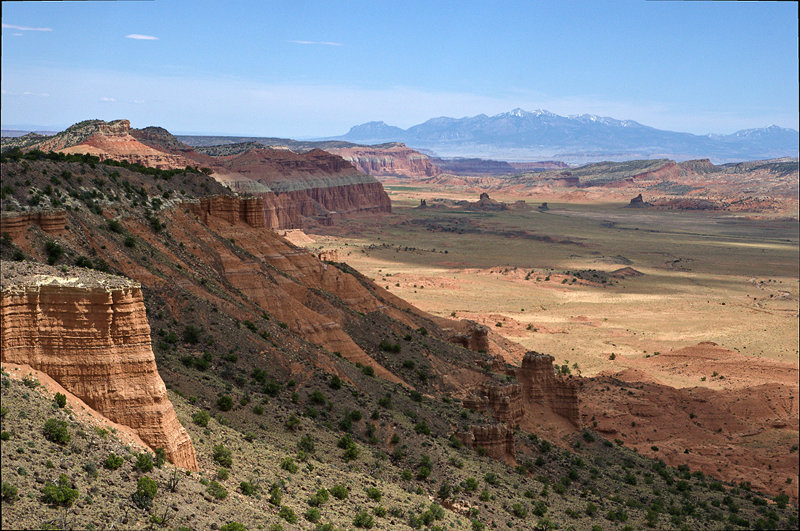
Painted Hills, Cathedral Valley, Capitol Reef NP, Utah
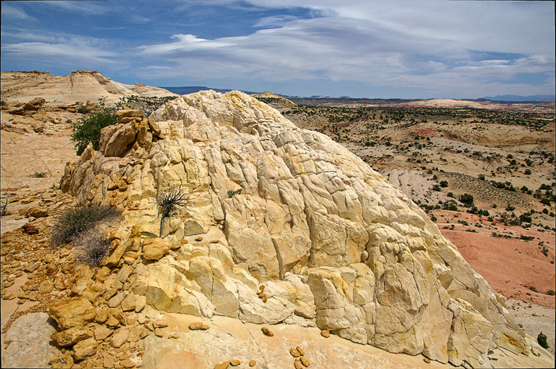 |
Yellow Rock, near Hwy 12, Grand Staircase Escalante NM, Utah
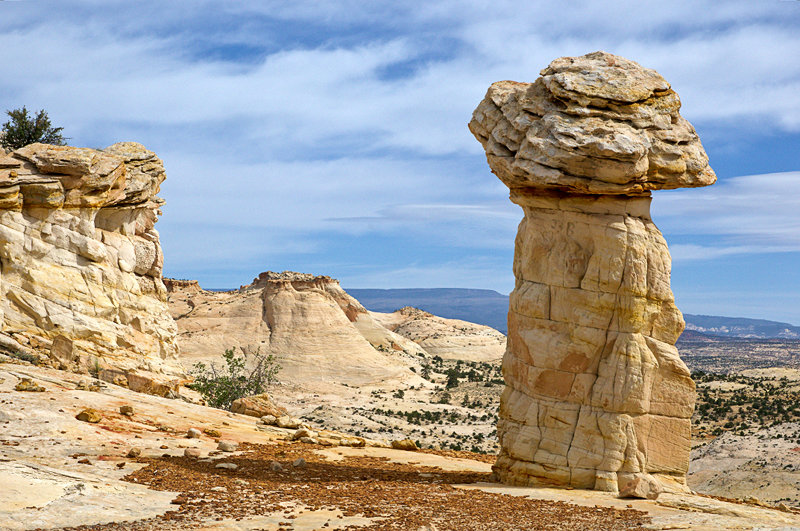 |
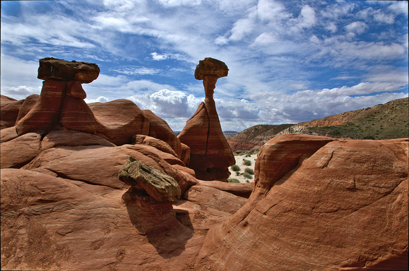
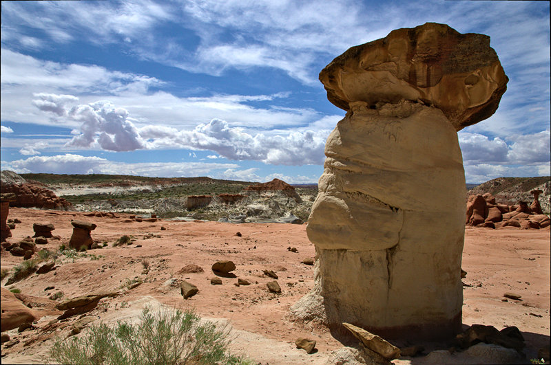
Hoodoo, near Hwy 12, Grand Staircase Escalante NM, Utah
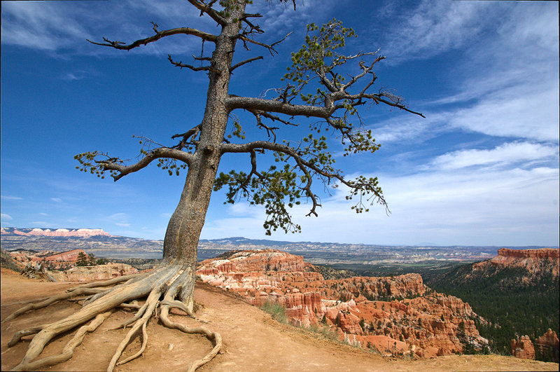 |
Near Sunrise Point, Bryce Canyon NP, Utah
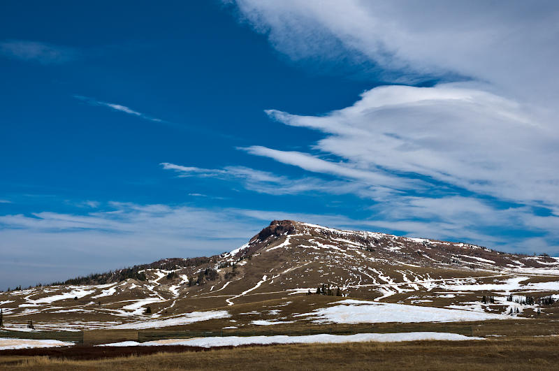 |
Brian Head, Utah
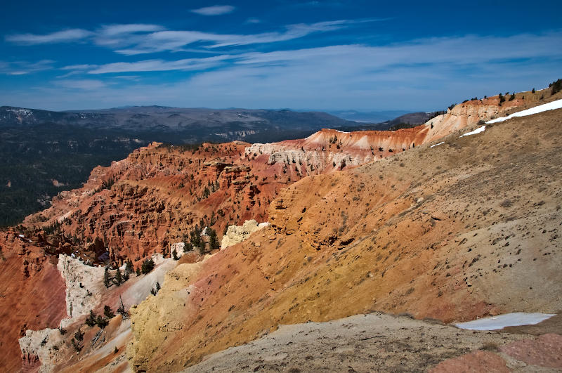 |
Cedar Breaks NM, Utah
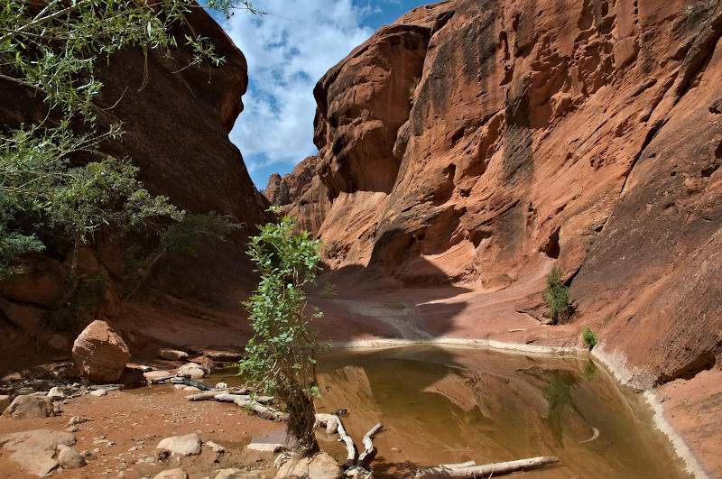 |
Small Pool, Red Cliffs Recreation Area, near St. George, Utah
 |
Blooming Yucca, Red Cliffs Recreation Area, near St. George, Utah